
Beale topographic map
Click on the map to display elevation.
About this map
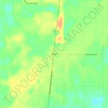
Name: Beale topographic map, elevation, terrain.
Location: Beale, Evangeline Parish, Louisiana, United States (30.80936 -92.43958 30.84936 -92.39958)
Average elevation: 125 ft
Minimum elevation: 66 ft
Maximum elevation: 177 ft
Other topographic maps
Click on a map to view its topography, its elevation and its terrain.
Ville Platte
United States > Louisiana > Evangeline Parish
Ville Platte is the largest city in, and the parish seat of, Evangeline Parish, Louisiana, United States. The population was 6,303 at the 2020 census, down from 8,145 in 2000. The city's name is of French origin, roughly translating to "flat town", in reference to its relatively flat topography in contrast to…
Average elevation: 72 ft