Geolocate

Dale topographic map

Click on the map to display elevation.

About this map

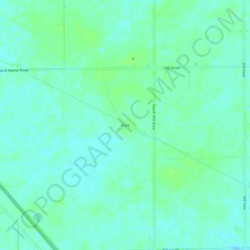
Name: Dale topographic map, elevation, terrain.

Location: Dale, Boone County, Indiana, United States (39.99671 -86.42000 40.03671 -86.38000)

Average elevation: 955 ft

Minimum elevation: 942 ft

Maximum elevation: 971 ft

Boone County trails, hiking, mountain biking, running and outdoor activities

Other topographic maps

Click on a map to view its topography, its elevation and its terrain.

Jamestown

United States > Indiana > Boone County

Average elevation: 958 ft

Thorntown

United States > Indiana > Boone County

Average elevation: 843 ft

Jamestown

United States > Indiana > Boone County > Jamestown

Average elevation: 958 ft

Advance

United States > Indiana > Boone County

Average elevation: 932 ft

Ulen

United States > Indiana > Boone County

Average elevation: 942 ft

Gear up for your next adventure:

🪶Wildlife Field Guides - Learn animal tracking and species ID
🌎3D Topographic Globes - Raised relief globes for a tactile understanding of geography
🏥Hiking First Aid Kits - Comprehensive medical kits for remote trail injuries
🎒Waterproof Dry Bags - Keep your electronics and maps dry inside your pack
🧣Hiking Neck Gaiter - Multi‑use neck protection for outdoor weather

As an Amazon Associate, this site earns from qualifying purchases at no extra cost to you.