Geolocate

Chatta topographic map

Click on the map to display elevation.

About this map

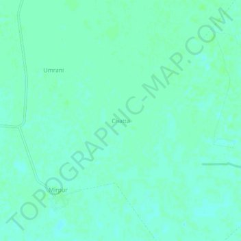
Name: Chatta topographic map, elevation, terrain.

Location: Chatta, Balochistan, Pakistan (28.52080 67.72641 28.56080 67.76641)

Average elevation: 226 ft

Minimum elevation: 213 ft

Maximum elevation: 233 ft

Other topographic maps

Click on a map to view its topography, its elevation and its terrain.

Chagai District

Pakistan > Balochistan

Average elevation: 3,015 ft

Quetta City Tehsil

Pakistan > Balochistan > Quetta District

Average elevation: 6,499 ft

Quetta District

Pakistan > Balochistan

Average elevation: 5,072 ft

Hanna Lake

Pakistan > Balochistan > Quetta

Average elevation: 6,421 ft

Khuzdar Tehsil

Pakistan > Balochistan > Khuzdar District

Average elevation: 3,232 ft

Ziarat Park

Pakistan > Balochistan > Quetta

Average elevation: 5,505 ft

Gear up for your next adventure:

🛡️Bear Spray Outdoor - Protection in bear country hikes
🧤Hiking Gloves - Protective gloves for rugged trails
🧦Hiking Socks - Comfortable socks to prevent blisters on long hikes
🪶Wildlife Field Guides - Learn animal tracking and species ID
🎒Gear Packing Cubes - Organize your backpack efficiently

As an Amazon Associate, this site earns from qualifying purchases at no extra cost to you.