
Moorhead topographic map
Interactive map
Click on the map to display elevation.
About this map
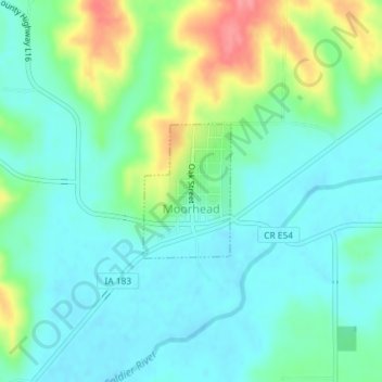
Name: Moorhead topographic map, elevation, terrain.
Location: Moorhead, Monona County, Iowa, United States (41.91900 -95.85603 41.92851 -95.84766)
Average elevation: 1,158 ft
Minimum elevation: 1,083 ft
Maximum elevation: 1,352 ft
Other topographic maps
Click on a map to view its topography, its elevation and its terrain.
Onawa
United States > Iowa > Monona County
Onawa, Monona County, Iowa, 51040, United States
Average elevation: 1,050 ft
Whiting
United States > Iowa > Monona County
Whiting, Monona County, Iowa, United States
Average elevation: 1,060 ft