Geolocate

Altötting topographic map

Click on the map to display elevation.

About this map

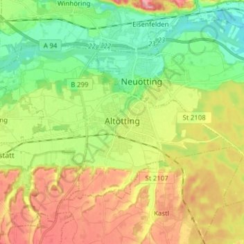
Name: Altötting topographic map, elevation, terrain.

Location: Altötting, Landkreis Altötting, Bavaria, 84503, Germany (48.19974 12.60763 48.25306 12.73285)

Average elevation: 1,332 ft

Minimum elevation: 1,161 ft

Maximum elevation: 1,565 ft

Gear up for your next adventure:

🧣Hiking Neck Gaiter - Multi‑use neck protection for outdoor weather
📖Nature Tracking Books - Learn to track wildlife and terrain
🧭Orienteering Set - Complete compass and map reading kit
🏫Relief Map Kits - Hands-on tools for teaching landforms and elevation
🔭Telescopic Hiking Pole - Adjustable pole for hiking stability

As an Amazon Associate, this site earns from qualifying purchases at no extra cost to you.