
Berkley topographic map
Click on the map to display elevation.
About this map
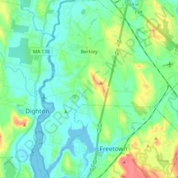
Name: Berkley topographic map, elevation, terrain.
Location: Berkley, Bristol County, Massachusetts, 02779, United States (41.77885 -71.12085 41.87297 -71.00744)
Average elevation: 56 ft
Minimum elevation: -13 ft
Maximum elevation: 210 ft
Bristol County trails, hiking, mountain biking, running and outdoor activities
Other topographic maps
Click on a map to view its topography, its elevation and its terrain.
Leonard and Marydee Flynn Cons Area
United States > Massachusetts > Bristol County > Mansfield
Average elevation: 128 ft
Source Is Shapefile From Town
United States > Massachusetts > Bristol County > Mansfield > Robinsonville
Average elevation: 164 ft
Daley Corner
United States > Massachusetts > Bristol County > Easton > North Easton
Average elevation: 154 ft
Rehoboth
United States > Massachusetts > Bristol County > Rehoboth > Rehoboth
Average elevation: 85 ft
Source Is Shapefile From Town
United States > Massachusetts > Bristol County > Mansfield > Robinsonville
Average elevation: 164 ft