Geolocate

Jordan topographic map

Click on the map to display elevation.

About this map

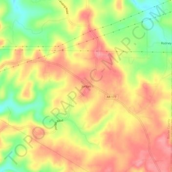
Name: Jordan topographic map, elevation, terrain.

Location: Jordan, Baxter County, Arkansas, 72519, United States (36.21285 -92.20432 36.25285 -92.16432)

Average elevation: 755 ft

Minimum elevation: 577 ft

Maximum elevation: 879 ft

Baxter County trails, hiking, mountain biking, running and outdoor activities

Other topographic maps

Click on a map to view its topography, its elevation and its terrain.

Gassville

United States > Arkansas > Baxter County

Average elevation: 656 ft

Salesville

United States > Arkansas > Baxter County

Average elevation: 558 ft

Big Flat

United States > Arkansas > Baxter County

Average elevation: 1,161 ft

Norfork Lake

United States > Arkansas > Baxter County

Average elevation: 741 ft

Briarcliff

United States > Arkansas > Baxter County

Average elevation: 774 ft

Gear up for your next adventure:

🔪Outdoor Multitools - Essential survival tools for gear repair and field use
🍳Camping Cook Set - Complete cookware for outdoor meals
🌲Outdoor Survival Books - Best books on survival skills
🛠️Backpacking Tool Kit - Essential toolkit for outdoor repairs
🔭Telescopic Hiking Pole - Adjustable pole for hiking stability

As an Amazon Associate, this site earns from qualifying purchases at no extra cost to you.