
Make a donation
Gear up for your next adventure:
As an Amazon Associate, this site earns from qualifying purchases at no extra cost to you.
Bee Island topographic map
Click on the map to display elevation.
Make a donation
Gear up for your next adventure:
As an Amazon Associate, this site earns from qualifying purchases at no extra cost to you.
About this map
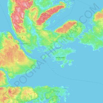
Name: Bee Island topographic map, elevation, terrain.
Average elevation: 141 ft
Minimum elevation: -10 ft
Maximum elevation: 994 ft
Make a donation
Gear up for your next adventure:
As an Amazon Associate, this site earns from qualifying purchases at no extra cost to you.
Other topographic maps
Click on a map to view its topography, its elevation and its terrain.
Bras d'Or Lake
Canada > Nova Scotia > Municipality of the County of Richmond > Red Islands
Average elevation: 95 ft
Make a donation
Gear up for your next adventure:
As an Amazon Associate, this site earns from qualifying purchases at no extra cost to you.
Lennox Passage Provincial Park
Canada > Nova Scotia > Municipality of the County of Richmond > Martinique
Average elevation: 23 ft
Make a donation
Gear up for your next adventure:
As an Amazon Associate, this site earns from qualifying purchases at no extra cost to you.
Lower L'Ardoise
Canada > Nova Scotia > Municipality of the County of Richmond
Average elevation: 72 ft
Make a donation
Gear up for your next adventure:
As an Amazon Associate, this site earns from qualifying purchases at no extra cost to you.
Garrets Lake
Canada > Nova Scotia > Municipality of the County of Richmond > Salmon River
Average elevation: 157 ft
Make a donation
Gear up for your next adventure:
As an Amazon Associate, this site earns from qualifying purchases at no extra cost to you.
River Bourgeois
Canada > Nova Scotia > Municipality of the County of Richmond
Average elevation: 69 ft
Barachois Pond
Canada > Nova Scotia > Municipality of the County of Richmond > Arichat
Average elevation: 52 ft
Make a donation
Gear up for your next adventure:
As an Amazon Associate, this site earns from qualifying purchases at no extra cost to you.
St. Marys
Canada > Nova Scotia > Municipality of the County of Richmond > St. Marys
Average elevation: 30 ft
Sampson Lake
Canada > Nova Scotia > Municipality of the County of Richmond > Louisdale
Average elevation: 23 ft
Make a donation
Gear up for your next adventure:
As an Amazon Associate, this site earns from qualifying purchases at no extra cost to you.
Make a donation
Gear up for your next adventure:
As an Amazon Associate, this site earns from qualifying purchases at no extra cost to you.