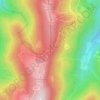
Moosch topographic map
Click on the map to display elevation.
About this map
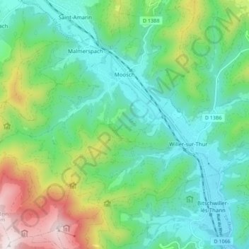
Name: Moosch topographic map, elevation, terrain.
Average elevation: 1,906 ft
Minimum elevation: 1,129 ft
Maximum elevation: 3,898 ft
Other topographic maps
Click on a map to view its topography, its elevation and its terrain.
Grand Ballon
France > Grand Est > Haut-Rhin > Goldbach-Altenbach
According to the Köppen climate classification, the top of the Grand Ballon features a subalpine climate (Köppen: Dfc) due to its high altitude comparable to the Alps or the Pyrenees. Along with the Hohneck the summit of the Grand Ballon is the coldest and windiest point in Alsace. A record low of −30.2…
Average elevation: 3,737 ft


Le Markstein
France > Grand Est > Haut-Rhin > Fellering
Le Markstein is a winter sports station in the Vosges mountains in France situated at an altitude of between 1,020 m (3,346 ft) and 1,268 m (4,160 ft) which is located on the Route des Crêtes. It forms a set of cross-country skiing with the Breitfirst ski-station and the Grand Ballon. The highest point is the…
Average elevation: 3,323 ft

Col du Platzerwasel
France > Grand Est > Haut-Rhin > Mittlach
The Col du Platzerwasel (elevation 1,182 m (3,878 ft)) is a mountain pass situated in the Vosges Mountains in the Haut-Rhin department of France, between Sondernach and Le Markstein. It has been crossed occasionally during the Tour de France cycle race, including on Stage 10 of the 2014 race.
Average elevation: 3,360 ft