
Make a donation
Gear up for your next adventure:
As an Amazon Associate, this site earns from qualifying purchases at no extra cost to you.
Ghorfine topographic map
Click on the map to display elevation.
Make a donation
Gear up for your next adventure:
As an Amazon Associate, this site earns from qualifying purchases at no extra cost to you.
About this map
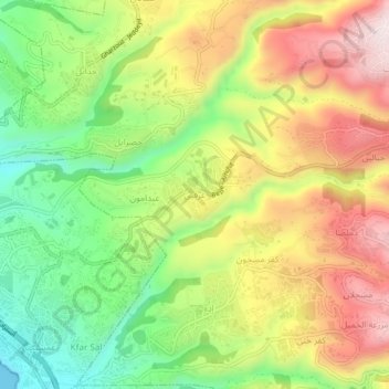
Name: Ghorfine topographic map, elevation, terrain.
Average elevation: 787 ft
Minimum elevation: 0 ft
Maximum elevation: 1,667 ft
Make a donation
Gear up for your next adventure:
As an Amazon Associate, this site earns from qualifying purchases at no extra cost to you.
Other topographic maps
Click on a map to view its topography, its elevation and its terrain.
Make a donation
Gear up for your next adventure:
As an Amazon Associate, this site earns from qualifying purchases at no extra cost to you.
Rayfoun
Lebanon > Keserwan-Jbeil Governorate
Rayfoun (Arabic: ريفون; also spelled Reifun or Raifoun) is a village and municipality located in the Keserwan District of the Keserwan-Jbeil Governorate of Lebanon. The village is about 28 kilometres (17 mi) north of Beirut. It has an average elevation of 1,050 meters above sea level and a total land area…
Average elevation: 3,248 ft
Ghazir
Lebanon > Keserwan-Jbeil Governorate
Ghazir (Arabic: غزير) is a town and municipality in the Keserwan District of the Keserwan-Jbeil Governorate of Lebanon. It is located 27 kilometres (17 mi) north of Beirut. It has an average elevation of 380 meters above sea level and a total land area of 542 hectares (2.09 sq mi).
Average elevation: 1,178 ft