Geolocate

Golden topographic map

Click on the map to display elevation.

About this map

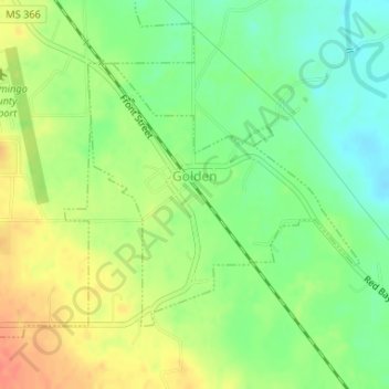
Name: Golden topographic map, elevation, terrain.

Location: Golden, Tishomingo County, Mississippi, United States (34.47788 -88.19608 34.49618 -88.17313)

Average elevation: 558 ft

Minimum elevation: 482 ft

Maximum elevation: 640 ft

Other topographic maps

Click on a map to view its topography, its elevation and its terrain.

Short

United States > Mississippi > Tishomingo County

Average elevation: 548 ft

Gear up for your next adventure:

🗺️Topographic Maps - Detailed topo maps for hiking, exploring and outdoor navigation
🪶LED Camping Lantern - Bright lantern for camp lighting
🔥Camping Stove - Portable stove for camping and backcountry cooking
🔊Portable Camp Speaker - Music and alerts at camp
🛡️Bear Spray Outdoor - Protection in bear country hikes

As an Amazon Associate, this site earns from qualifying purchases at no extra cost to you.