Geolocate

Kentuck topographic map

Click on the map to display elevation.

About this map

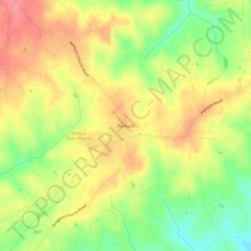
Name: Kentuck topographic map, elevation, terrain.

Location: Kentuck, Pittsylvania County, Virginia, 24566, United States (36.63986 -79.31835 36.67986 -79.27835)

Average elevation: 682 ft

Minimum elevation: 515 ft

Maximum elevation: 823 ft

Pittsylvania County trails, hiking, mountain biking, running and outdoor activities

Other topographic maps

Click on a map to view its topography, its elevation and its terrain.

Chatham

United States > Virginia > Pittsylvania County

Average elevation: 686 ft

Gear up for your next adventure:

📚Navigation Handbooks - Master the art of reading topographic maps and using a compass
📌Outdoor GPS Map App - Apps and devices for digital topographic navigation
🔋Rechargeable Batteries - Power up your outdoor devices
🧦Merino Wool Socks - Moisture-wicking, blister-preventing socks for long treks
🪑Ultralight Camp Chairs - Portable seating for resting after a long day of mapping

As an Amazon Associate, this site earns from qualifying purchases at no extra cost to you.