Geolocate

Perry topographic map

Interactive map

Click on the map to display elevation.

About this map

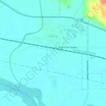
Name: Perry topographic map, elevation, terrain.

Location: Perry, Jefferson County, Kansas, United States (39.06232 -95.40362 39.08069 -95.37272)

Average elevation: 856 ft

Minimum elevation: 827 ft

Maximum elevation: 1,060 ft

Other topographic maps

Click on a map to view its topography, its elevation and its terrain.

Oskaloosa

United States > Kansas > Jefferson County

Oskaloosa, Jefferson County, Kansas, United States

Average elevation: 1,079 ft

Winchester

United States > Kansas > Jefferson County

Winchester, Jefferson County, Kansas, United States

Average elevation: 1,155 ft

Nortonville

United States > Kansas > Jefferson County

Nortonville, Jefferson County, Kansas, 66060, United States

Average elevation: 1,142 ft

Valley Falls

United States > Kansas > Jefferson County

Valley Falls, Jefferson County, Kansas, United States

Average elevation: 945 ft

McLouth

United States > Kansas > Jefferson County

McLouth, Jefferson County, Kansas, United States

Average elevation: 1,148 ft

Valley Falls

United States > Kansas > Jefferson County > Valley Falls > Valley Falls

Valley Falls, Jefferson County, Kansas, 66088, United States

Average elevation: 971 ft