Geolocate

Cedaredge topographic map

Click on the map to display elevation.

Cedaredge

Located in a protected valley at 6,100 feet (1,900 m) in elevation, the Cedaredge Golf Club course has natural cedars and winding creek beds.

Wikipedia (CC-BY-SA 3.0)

About this map

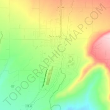
Name: Cedaredge topographic map, elevation, terrain.

Location: Cedaredge, Delta County, Colorado, United States (38.87564 -107.93799 38.91431 -107.91177)

Average elevation: 6,178 ft

Minimum elevation: 5,725 ft

Maximum elevation: 6,699 ft

Delta County trails, hiking, mountain biking, running and outdoor activities

Other topographic maps

Click on a map to view its topography, its elevation and its terrain.

Hotchkiss

United States > Colorado > Delta County

Average elevation: 5,430 ft

Austin

United States > Colorado > Delta County

Average elevation: 5,171 ft

Orchard City

United States > Colorado > Delta County

Average elevation: 5,443 ft

Gear up for your next adventure:

🎒Gear Packing Cubes - Organize your backpack efficiently
📦Gear Storage Bags - Organize and protect outdoor equipment
🧭Pro Hiking Compasses - High-accuracy liquid-filled compasses for topographic orientation
🔋Solar Power Banks - Keep your GPS and phone charged in remote wilderness areas
🎒Trail Energy Bars - High‑calorie bars for hiking energy

As an Amazon Associate, this site earns from qualifying purchases at no extra cost to you.