
Jurm topographic map
Interactive map
Click on the map to display elevation.
About this map
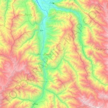
Name: Jurm topographic map, elevation, terrain.
Location: Jurm, Badakhshan Province, Afghanistan (36.49484 70.63790 37.00621 71.20708)
Average elevation: 9,803 ft
Minimum elevation: 4,544 ft
Maximum elevation: 17,287 ft
Other topographic maps
Click on a map to view its topography, its elevation and its terrain.
Zebak
Afghanistan > Badakhshan Province
Zebak, Badakhshan Province, Afghanistan
Average elevation: 13,465 ft
Korut
Afghanistan > Badakhshan Province > Korut
Korut, Wakhan, Badakhshan Province, Afghanistan
Average elevation: 11,598 ft