
龙泉街道 topographic map
Interactive map
Click on the map to display elevation.
About this map
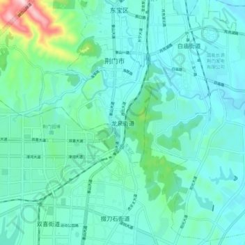
Name: 龙泉街道 topographic map, elevation, terrain.
Location: 龙泉街道, 荆门市, 湖北省, 448001, 中国 (30.97712 112.15697 31.05712 112.23697)
Average elevation: 436 ft
Minimum elevation: 200 ft
Maximum elevation: 1,677 ft
Other topographic maps
Click on a map to view its topography, its elevation and its terrain.