Geolocate

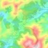
Lena topographic map

Click on the map to display elevation.

About this map

Name: Lena topographic map, elevation, terrain.

Location: Lena, Asturias, Spain (42.96262 -5.96079 43.20349 -5.68754)

Average elevation: 3,635 ft

Minimum elevation: 807 ft

Maximum elevation: 7,815 ft

Other topographic maps

Click on a map to view its topography, its elevation and its terrain.
El Ferrol

Spain > Asturias > Castropol

Average elevation: 128 ft

Chagos

Spain > Asturias > Cangas del Narcea > Ḷḷarón > La Vilieḷḷa

Average elevation: 3,143 ft

Avín

Spain > Asturias > Onís > Benia de Onís

Average elevation: 1,289 ft

Liares

Spain > Asturias > Ibias

Average elevation: 2,339 ft

El Retornu

Spain > Asturias > Piloña

Average elevation: 1,942 ft

Sotrondio

Spain > Asturias > Samartín del Rei Aurelio

Average elevation: 1,391 ft

La Barganiza

Spain > Asturias > Siero

Average elevation: 653 ft

Boriñes

Spain > Asturias > Piloña

Average elevation: 1,017 ft

Mones

Spain > Asturias > Valdés

Average elevation: 1,552 ft

Siecha

Spain > Asturias > Cangas del Narcea

Average elevation: 2,927 ft

Gear up for your next adventure:

🪶Thermal Camp Blanket - Extra warmth for cold nights
🦺Reflective Outdoor Gear - Safety gear for low‑light conditions
🥤Water Filter Bottle - All‑in‑one filter bottle for safe hydration
🍳Camping Cook Set - Complete cookware for outdoor meals
👟Men's Trail Runners - Lightweight footwear for fast-paced exploration and light hiking

As an Amazon Associate, this site earns from qualifying purchases at no extra cost to you.