
Make a donation
Gear up for your next adventure:
As an Amazon Associate, this site earns from qualifying purchases at no extra cost to you.
Flat Rock topographic map
Click on the map to display elevation.
Make a donation
Gear up for your next adventure:
As an Amazon Associate, this site earns from qualifying purchases at no extra cost to you.
About this map
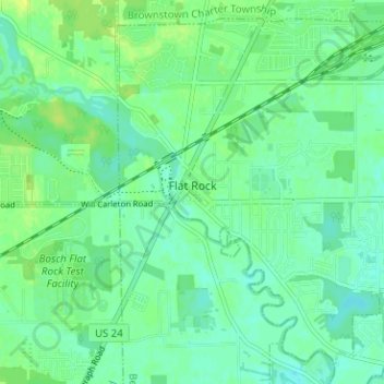
Name: Flat Rock topographic map, elevation, terrain.
Location: Flat Rock, Wayne County, Michigan, United States (42.07424 -83.30432 42.11688 -83.24119)
Average elevation: 600 ft
Minimum elevation: 577 ft
Maximum elevation: 627 ft
Make a donation
Gear up for your next adventure:
As an Amazon Associate, this site earns from qualifying purchases at no extra cost to you.
Other topographic maps
Click on a map to view its topography, its elevation and its terrain.
Make a donation
Gear up for your next adventure:
As an Amazon Associate, this site earns from qualifying purchases at no extra cost to you.
Kresge Ford Basement Courtyard
United States > Michigan > Wayne County > Detroit
Average elevation: 633 ft
Make a donation
Gear up for your next adventure:
As an Amazon Associate, this site earns from qualifying purchases at no extra cost to you.
Greenfield Village
United States > Michigan > Wayne County > Greenfield Village
Average elevation: 604 ft