
Thank you for supporting this site ❤️
Make a donation
Make a donation
Gear up for your next adventure:
As an Amazon Associate, this site earns from qualifying purchases at no extra cost to you.
Pustertal - Val Pusteria topographic map
Click on the map to display elevation.
Thank you for supporting this site ❤️
Make a donation
Make a donation
Gear up for your next adventure:
As an Amazon Associate, this site earns from qualifying purchases at no extra cost to you.
About this map
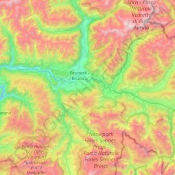
Name: Pustertal - Val Pusteria topographic map, elevation, terrain.
Average elevation: 5,853 ft
Minimum elevation: 2,096 ft
Maximum elevation: 11,145 ft
Thank you for supporting this site ❤️
Make a donation
Make a donation
Gear up for your next adventure:
As an Amazon Associate, this site earns from qualifying purchases at no extra cost to you.
Other topographic maps
Click on a map to view its topography, its elevation and its terrain.
Aufkirchen - Santa Maria
Italy > Trentino – Alto Adige/Südtirol > South Tyrol > Toblach - Dobbiaco
Average elevation: 4,682 ft