
Thank you for supporting this site ❤️
Make a donation
Make a donation
Gear up for your next adventure:
As an Amazon Associate, this site earns from qualifying purchases at no extra cost to you.
Saint-Constant topographic map
Click on the map to display elevation.
Thank you for supporting this site ❤️
Make a donation
Make a donation
Gear up for your next adventure:
As an Amazon Associate, this site earns from qualifying purchases at no extra cost to you.
About this map
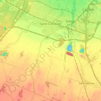
Name: Saint-Constant topographic map, elevation, terrain.
Location: Saint-Constant, Roussillon, Montérégie, Quebec, Canada (45.29562 -73.66055 45.39536 -73.51618)
Average elevation: 121 ft
Minimum elevation: -39 ft
Maximum elevation: 207 ft
Thank you for supporting this site ❤️
Make a donation
Make a donation
Gear up for your next adventure:
As an Amazon Associate, this site earns from qualifying purchases at no extra cost to you.