Geolocate

Grad Novska topographic map

Click on the map to display elevation.

About this map

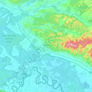
Name: Grad Novska topographic map, elevation, terrain.

Location: Grad Novska, Sisak-Moslavina County, Croatia (45.23835 16.80871 45.43868 17.19491)

Average elevation: 423 ft

Minimum elevation: 282 ft

Maximum elevation: 1,526 ft

Gear up for your next adventure:

🥇GPS Hiking Watch - Multi‑sport GPS watch with navigation and trail tracking
🏔️Mountain Trail Maps - High‑detail maps for popular peaks
🧢Sun Protection Hats - Wide-brimmed and UPF-rated hats for high-altitude sun safety
🔪Outdoor Multitools - Essential survival tools for gear repair and field use
🔭Stargazing Telescopes - Perfect for camping in low-light pollution areas shown on maps

As an Amazon Associate, this site earns from qualifying purchases at no extra cost to you.