
Valle topographic map
Click on the map to display elevation.
Valle
Valle (Grand Canyon Junction) is a census-designated place in Coconino County, Arizona, United States. As of the 2010 US Census the population of Valle was 832. It lies at an altitude of 5,994 feet (1,827 m), at the junction of U.S. Route 180 and State Route 64. Its attractions include the Valle Airport (40G), the Planes of Fame Air Museum, and Birds of Prey, formally Bedrock City (Arizona), amusement park. Drivers often stop at the town on their way to the Grand Canyon from either Williams or Flagstaff, as it is approximately at the halfway point.
About this map
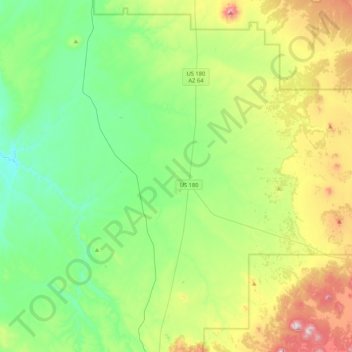
Name: Valle topographic map, elevation, terrain.
Location: Valle, Coconino County, Arizona, United States (35.49654 -112.36742 35.82410 -111.94617)
Average elevation: 6,102 ft
Minimum elevation: 5,545 ft
Maximum elevation: 7,411 ft
Coconino County trails, hiking, mountain biking, running and outdoor activities
Other topographic maps
Click on a map to view its topography, its elevation and its terrain.
Flagstaff
United States > Arizona > Coconino County
Flagstaff, located in Coconino County, Arizona, is characterized by its diverse topography, primarily shaped by its high elevation and volcanic activity. Sitting at around 7,000 feet (approximately 2,130 meters), the city is surrounded by the expansive Coconino National Forest, which features a blend of…
Average elevation: 7,139 ft
Flagstaff
United States > Arizona > Coconino County
Flagstaff is the county seat of Coconino County. According to the United States Census Bureau, the city has a total area of 63.9 square miles (165.5 km2), of which only 0.03 square miles (0.08 km2) (0.08%) is water. Flagstaff lies at approximately 7,000 feet (2,130 m) elevation, and is surrounded by the…
Average elevation: 7,316 ft
Upper Saginaw Reservoir
United States > Arizona > Coconino County > Williams City Limits
Average elevation: 7,051 ft
Glen Canyon Dam
United States > Arizona > Coconino County
The Bureau of Reclamation favored the Echo Park site over Glen Canyon, because its narrow canyons and high elevation (more than 5,000 feet (1,500 m), as compared to 3,700 feet (1,100 m) at Glen Canyon) would lead to less evaporation. It said that building Echo Park Dam and a "low" Glen Canyon Dam would save…
Average elevation: 3,842 ft
Page
United States > Arizona > Coconino County > Page
Unlike other cities in the area, Page was founded in 1957 as a housing community for workers and their families during the construction of nearby Glen Canyon Dam on the Colorado River. Its 17-square-mile (44 km2) site was obtained in a land exchange with the Navajo Nation. The city is perched atop Manson Mesa…
Average elevation: 4,075 ft
South Rim
United States > Arizona > Coconino County > Grand Canyon Village
Average elevation: 6,096 ft
Supai
United States > Arizona > Coconino County > Supai
Supai can be reached by hiking 8 miles (13 km), descending 2,004 feet (611 m) in elevation from Hualapai Hilltop through the Hualapai Canyon. Alternatively, the AirWest Helicopters service schedules flights from Hualapai Hilltop to Supai. Hualapai Hilltop is located about 70 miles (110 km) from the community…
Average elevation: 4,144 ft