Geolocate

Hartford topographic map

Click on the map to display elevation.

About this map

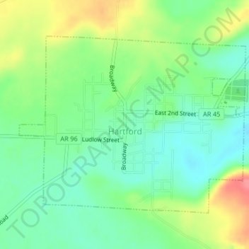
Name: Hartford topographic map, elevation, terrain.

Location: Hartford, Sebastian County, Arkansas, United States (35.01400 -94.39534 35.03318 -94.36536)

Average elevation: 686 ft

Minimum elevation: 594 ft

Maximum elevation: 840 ft

Sebastian County trails, hiking, mountain biking, running and outdoor activities

Other topographic maps

Click on a map to view its topography, its elevation and its terrain.

Fort Smith

United States > Arkansas > Sebastian County > Fort Smith

Average elevation: 535 ft

Old Jenny Lind

United States > Arkansas > Sebastian County

Average elevation: 551 ft

Gear up for your next adventure:

🪶Fire Starter Kit - Reliable fire starter for survival and camping
🔦Compact Flashlight - Reliable flashlight for emergencies
🦶Carbon Trekking Poles - Reduce knee impact on steep descents with ultra-light poles
🔋Solar Power Banks - Keep your GPS and phone charged in remote wilderness areas
🎁Geography Themed Gifts - Unique gift ideas for map lovers and geography enthusiasts

As an Amazon Associate, this site earns from qualifying purchases at no extra cost to you.