Geolocate

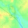
Cameron topographic map

Click on the map to display elevation.

About this map

Name: Cameron topographic map, elevation, terrain.

Location: Cameron, Bath Township, Cerro Gordo County, Iowa, 50401, United States (43.06258 -93.20861 43.10258 -93.16861)

Average elevation: 1,211 ft

Minimum elevation: 1,161 ft

Maximum elevation: 1,243 ft

Cerro Gordo County trails, hiking, mountain biking, running and outdoor activities

Other topographic maps

Click on a map to view its topography, its elevation and its terrain.

Clear Lake

United States > Iowa > Cerro Gordo County

Average elevation: 1,224 ft

Mason City

United States > Iowa > Cerro Gordo County

Average elevation: 1,155 ft

Mason City

United States > Iowa > Cerro Gordo County

Average elevation: 1,155 ft

Rockwell

United States > Iowa > Cerro Gordo County

Average elevation: 1,125 ft

Rockwell

United States > Iowa > Cerro Gordo County

Average elevation: 1,125 ft

Clear Lake

United States > Iowa > Cerro Gordo County

Average elevation: 1,224 ft

Rock Falls

United States > Iowa > Cerro Gordo County

Average elevation: 1,122 ft

Clear Lake

United States > Iowa > Cerro Gordo County

Average elevation: 1,224 ft

Rockwell

United States > Iowa > Cerro Gordo County

Average elevation: 1,125 ft

Gear up for your next adventure:

📱Heavy-Duty Phone Cases - Drop-proof and waterproof protection for outdoor navigation
🪶Fire Starter Kit - Reliable fire starter for survival and camping
🦺Reflective Outdoor Gear - Safety gear for low‑light conditions
⛑️Personal Locator Beacon - Safety beacon for emergencies
🧢Outdoor Hiking Hat - Sun protection hat for outdoor explorers

As an Amazon Associate, this site earns from qualifying purchases at no extra cost to you.