Geolocate

Ruza topographic map

Click on the map to display elevation.

About this map
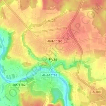
Name: Ruza topographic map, elevation, terrain.

Location: Ruza, Ruzsky District, Moscow Oblast, Central Federal District, 143100, Russia (55.68560 36.16651 55.71804 36.22745)

Average elevation: 627 ft

Minimum elevation: 509 ft

Maximum elevation: 702 ft

Other topographic maps

Click on a map to view its topography, its elevation and its terrain.

Пупки

Russia > Moscow Oblast > Ruzsky District

Average elevation: 768 ft

Lidino

Russia > Moscow Oblast > Ruzsky District

Average elevation: 646 ft

Dorokhovo

Russia > Moscow Oblast > Ruzsky District

Average elevation: 719 ft

Gear up for your next adventure:

🪵Folding Camp Saw - Compact saw for wood and campsite work
🎒Hydration Pack - Hands‑free water reservoir for long hikes
🎒Gear Packing Cubes - Organize your backpack efficiently
🖼️Topo Map Wall Art - Decorative topographic prints of famous peaks and regions
🪶Camp Gear Gift Set - Perfect gift bundle for outdoor fans

As an Amazon Associate, this site earns from qualifying purchases at no extra cost to you.