Geolocate

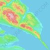
Sunny Bank topographic map

Click on the map to display elevation.

About this map

Name: Sunny Bank topographic map, elevation, terrain.

Location: Sunny Bank, Gaspé, La Côte-de-Gaspé, Gaspésie–Îles-de-la-Madeleine, Quebec, G4X 2A1, Canada (48.81402 -64.62094 48.85402 -64.58094)

Average elevation: 207 ft

Minimum elevation: -13 ft

Maximum elevation: 928 ft

Other topographic maps

Click on a map to view its topography, its elevation and its terrain.

Gaspé

Canada > Quebec > La Côte-de-Gaspé > Gaspé

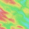
Average elevation: 469 ft

Lac Caribou

Canada > Quebec > La Côte-de-Gaspé > Gaspé

Average elevation: 863 ft

Gear up for your next adventure:

🧥Men's Rain Shells - Premium waterproof and breathable jackets for mountain weather
🗺️NatGeo Topo Maps - High-quality waterproof printed topographic maps of US Parks
🛡️Insect Repellent - Protection against bugs during outdoor activities
🎒Day Hiking Backpack - Lightweight backpack perfect for day trips and outdoor adventures
🌡️Portable Weather Meter - Track weather conditions on the trail

As an Amazon Associate, this site earns from qualifying purchases at no extra cost to you.