
珞珈山街道 topographic map
Interactive map
Click on the map to display elevation.
About this map
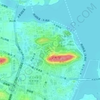
Name: 珞珈山街道 topographic map, elevation, terrain.
Location: 珞珈山街道, 武昌区, 武汉市, 湖北省, 中国 (30.53059 114.33776 30.54853 114.37220)
Average elevation: 105 ft
Minimum elevation: 52 ft
Maximum elevation: 367 ft
Other topographic maps
Click on a map to view its topography, its elevation and its terrain.