
白沙洲街道 topographic map
Interactive map
Click on the map to display elevation.
About this map
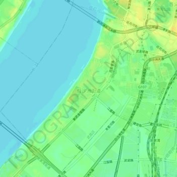
Name: 白沙洲街道 topographic map, elevation, terrain.
Location: 白沙洲街道, 武昌区, 武汉市, 湖北省, 中国 (30.49766 114.25906 30.53377 114.30308)
Average elevation: 72 ft
Minimum elevation: 46 ft
Maximum elevation: 115 ft
Other topographic maps
Click on a map to view its topography, its elevation and its terrain.