
Henry topographic map
Click on the map to display elevation.
About this map
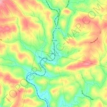
Name: Henry topographic map, elevation, terrain.
Location: Henry, Franklin County, Virginia, 24102, United States (36.80930 -80.01171 36.84930 -79.97171)
Average elevation: 1,043 ft
Minimum elevation: 820 ft
Maximum elevation: 1,257 ft
Franklin County trails, hiking, mountain biking, running and outdoor activities
Other topographic maps
Click on a map to view its topography, its elevation and its terrain.