Geolocate

Sweetser topographic map

Click on the map to display elevation.

About this map

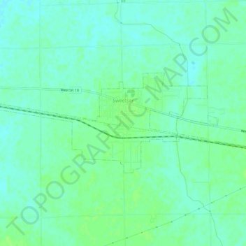
Name: Sweetser topographic map, elevation, terrain.

Location: Sweetser, Grant County, Indiana, 46987, United States (40.55956 -85.80296 40.57667 -85.74784)

Average elevation: 843 ft

Minimum elevation: 827 ft

Maximum elevation: 863 ft

Grant County trails, hiking, mountain biking, running and outdoor activities

Other topographic maps

Click on a map to view its topography, its elevation and its terrain.

Dooville

United States > Indiana > Grant County > Marion

Average elevation: 863 ft

Gear up for your next adventure:

🪶Camp Gear Gift Set - Perfect gift bundle for outdoor fans
🔥Camping Stove - Portable stove for camping and backcountry cooking
🗃️Trail First Aid Kit - Essential kit for outdoor injuries and emergencies
🛶Inflatable Kayak - Portable kayak for rivers, lakes, and expeditions
🛠️Outdoor Gear Repair Kit - Essential tools to fix gear on the trail

As an Amazon Associate, this site earns from qualifying purchases at no extra cost to you.