
Thank you for supporting this site ❤️
Make a donation
Make a donation
Gear up for your next adventure:
As an Amazon Associate, this site earns from qualifying purchases at no extra cost to you.
Montes Azules topographic map
Click on the map to display elevation.
Thank you for supporting this site ❤️
Make a donation
Make a donation
Gear up for your next adventure:
As an Amazon Associate, this site earns from qualifying purchases at no extra cost to you.
About this map
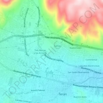
Name: Montes Azules topographic map, elevation, terrain.
Location: Montes Azules, Tuxtla Gutiérrez, Chiapas, 29025, México (16.74927 -93.18805 16.78927 -93.14805)
Average elevation: 2,149 ft
Minimum elevation: 1,801 ft
Maximum elevation: 3,156 ft
Thank you for supporting this site ❤️
Make a donation
Make a donation
Gear up for your next adventure:
As an Amazon Associate, this site earns from qualifying purchases at no extra cost to you.
Other topographic maps
Click on a map to view its topography, its elevation and its terrain.
Parque Jardines del Pedregal
México > Chiapas > Tuxtla Gutiérrez > Tuxtla Gutiérrez
Average elevation: 1,814 ft