
Stams topographic map
Interactive map
Click on the map to display elevation.
About this map
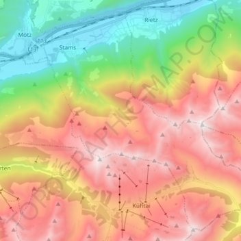
Name: Stams topographic map, elevation, terrain.
Location: Stams, Bezirk Imst, 6422, Österreich (47.20358 10.95386 47.29106 11.09471)
Average elevation: 5,666 ft
Minimum elevation: 2,047 ft
Maximum elevation: 9,367 ft
Other topographic maps
Click on a map to view its topography, its elevation and its terrain.
Vent
Österreich > Bezirk Imst > Sölden
Vent, Sölden, Bezirk Imst, 6458, Österreich
Average elevation: 7,779 ft
Unterlängenfeld
Österreich > Bezirk Imst > Längenfeld
Unterlängenfeld, Längenfeld, Bezirk Imst, 6444, Österreich
Average elevation: 5,262 ft
Hochimst
Österreich > Bezirk Imst > Imst
Hochimst, Imst, Bezirk Imst, 6460, Österreich
Average elevation: 3,520 ft