
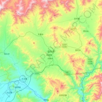
五台县 topographic map
Interactive map
Click on the map to display elevation.
About this map
Name: 五台县 topographic map, elevation, terrain.
Location: 五台县, 忻州市, 山西省, 中国 (38.57494 113.09762 38.89494 113.41762)
Average elevation: 3,940 ft
Minimum elevation: 2,339 ft
Maximum elevation: 7,077 ft
境东北为五台山,地势东北高,西南低。最高峰北台顶,海拔3058米。
Other topographic maps
Click on a map to view its topography, its elevation and its terrain.