Geolocate

Devprayag topographic map

Click on the map to display elevation.

About this map

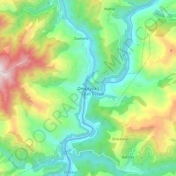
Name: Devprayag topographic map, elevation, terrain.

Location: Devprayag, Tehri Garhwal, Uttarakhand, 249301, India (30.10614 78.55858 30.18614 78.63858)

Average elevation: 3,117 ft

Minimum elevation: 1,450 ft

Maximum elevation: 6,558 ft

Gear up for your next adventure:

😴Insulated Sleeping Pads - Compact and warm pads for high-elevation camping
🎒Outdoor Daypacks - Lightweight backpacks designed for carrying maps and essential gear
🛡️Bear Spray Outdoor - Protection in bear country hikes
🏥Hiking First Aid Kits - Comprehensive medical kits for remote trail injuries
🕶️Glacier Sunglasses - Side shields to protect eyes from high-altitude snow glare

As an Amazon Associate, this site earns from qualifying purchases at no extra cost to you.