Geolocate

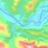
Devprayag topographic maps

Click on a map to view its topography, its elevation and its terrain.

nagar

India > Uttarakhand > Devprayag > nagar

Average elevation: 3,100 ft

Kirtinagar

India > Uttarakhand > Devprayag

Average elevation: 2,323 ft

budena

India > Uttarakhand > Devprayag > jakhand

Average elevation: 4,052 ft

Devprayag

India > Uttarakhand > Devprayag

Average elevation: 3,117 ft

About this place

 •

Gear up for your next adventure:

⛺Backpacking Tents - Weight-optimized shelters for multi-day topographic surveys
📻Weather Alert Radios - Stay informed of storm risks while off-the-grid
🧢Sun Protection Hats - Wide-brimmed and UPF-rated hats for high-altitude sun safety
🥾Hiking Shoes - Durable and comfortable shoes for trail hiking
📱Heavy-Duty Phone Cases - Drop-proof and waterproof protection for outdoor navigation

As an Amazon Associate, this site earns from qualifying purchases at no extra cost to you.