Geolocate

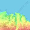
Villalmarzo topographic map

Click on the map to display elevation.

Villalmarzo

La aldea se sitúa a una altitud de 200 m y dista 7,5 km de la villa de La Caridad, capital del concejo.

Wikipedia (CC-BY-SA 3.0)

About this map

Name: Villalmarzo topographic map, elevation, terrain.

Location: Villalmarzo, El Franco, Asturias, España (43.48807 -6.87852 43.51729 -6.83662)

Average elevation: 610 ft

Minimum elevation: 144 ft

Maximum elevation: 1,184 ft

Other topographic maps

Click on a map to view its topography, its elevation and its terrain.

Mernes

España > Asturias > El Franco

Average elevation: 125 ft

Viavélez

España > Asturias > El Franco > La Caridad

Average elevation: 89 ft

Gear up for your next adventure:

🧴Hand Sanitizer - Keep hands clean while hiking
🛌Ultralight Sleeping Bags - Compact down bags for cold nights in the wilderness
🏥Hiking First Aid Kits - Comprehensive medical kits for remote trail injuries
📚Navigation Handbooks - Master the art of reading topographic maps and using a compass
🌧️Backpack Rain Cover - Keep gear dry in wet weather

As an Amazon Associate, this site earns from qualifying purchases at no extra cost to you.