
宏盘乡 topographic map
Interactive map
Click on the map to display elevation.
About this map
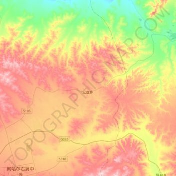
Name: 宏盘乡 topographic map, elevation, terrain.
Location: 宏盘乡, 察哈尔右翼中旗, 乌兰察布市, 内蒙古自治区, 中国 (41.29554 112.48527 41.52620 112.85642)
Average elevation: 5,518 ft
Minimum elevation: 4,813 ft
Maximum elevation: 6,243 ft
Other topographic maps
Click on a map to view its topography, its elevation and its terrain.