Geolocate

Pierceville topographic map

Click on the map to display elevation.

About this map

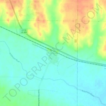
Name: Pierceville topographic map, elevation, terrain.

Location: Pierceville, Finney County, Kansas, 67868, United States (37.86159 -100.69643 37.90159 -100.65643)

Average elevation: 2,782 ft

Minimum elevation: 2,733 ft

Maximum elevation: 2,864 ft

Finney County trails, hiking, mountain biking, running and outdoor activities

Other topographic maps

Click on a map to view its topography, its elevation and its terrain.

Holcomb

United States > Kansas > Finney County

Average elevation: 2,884 ft

Gear up for your next adventure:

Solar GPS Watches - Advanced multisport watches with built-in topographic maps
🪑Portable Camp Table - Compact table for campsite meals
🔭Telescopic Hiking Pole - Adjustable pole for hiking stability
🧭Pro Hiking Compasses - High-accuracy liquid-filled compasses for topographic orientation
🌲Outdoor Survival Books - Best books on survival skills

As an Amazon Associate, this site earns from qualifying purchases at no extra cost to you.