Geolocate

Holcomb topographic map

Click on the map to display elevation.

About this map

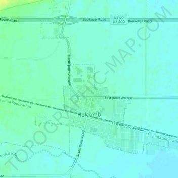
Name: Holcomb topographic map, elevation, terrain.

Location: Holcomb, Finney County, Kansas, United States (37.97838 -101.01159 38.00268 -100.97015)

Average elevation: 2,884 ft

Minimum elevation: 2,867 ft

Maximum elevation: 2,930 ft

Finney County trails, hiking, mountain biking, running and outdoor activities

Other topographic maps

Click on a map to view its topography, its elevation and its terrain.

Pierceville

United States > Kansas > Finney County

Average elevation: 2,782 ft

Plymell

United States > Kansas > Finney County

Average elevation: 2,881 ft

Garden City

United States > Kansas > Finney County > Garden City > Garden City

Average elevation: 2,894 ft

Ravanna

United States > Kansas > Finney County > Ravanna

Average elevation: 2,566 ft

Gear up for your next adventure:

🏕️Tent Footprint - Protect your tent base from wear
🚪Portable Camp Chair - Foldable chair for comfort at camp
🥾Women's Hiking Boots - Top-rated trail boots with ankle support and superior grip
🏔️Mountain Trail Maps - High‑detail maps for popular peaks
🔭Telescopic Hiking Pole - Adjustable pole for hiking stability

As an Amazon Associate, this site earns from qualifying purchases at no extra cost to you.