Geolocate

Nakhola topographic map

Click on the map to display elevation.

About this map

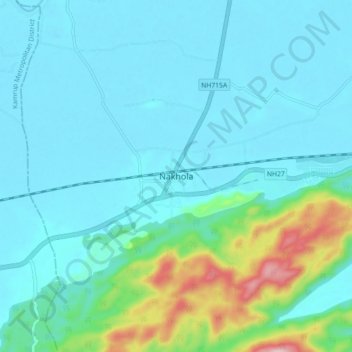
Name: Nakhola topographic map, elevation, terrain.

Location: Nakhola, Mayong, Marigaon District, Assam, 782410, India (26.08486 92.16125 26.16486 92.24125)

Average elevation: 338 ft

Minimum elevation: 167 ft

Maximum elevation: 1,237 ft

Other topographic maps

Click on a map to view its topography, its elevation and its terrain.

Mayong

India > Assam > Mayong

Average elevation: 285 ft

Gear up for your next adventure:

🪓Survival Multi‑Tool - Versatile tool for camp and trail tasks
🪑Portable Camp Table - Compact table for campsite meals
🏕️Tent Footprint - Protect your tent base from wear
🧥Men's Rain Shells - Premium waterproof and breathable jackets for mountain weather
🧭Outdoor Navigation Book - Learn advanced navigation skills

As an Amazon Associate, this site earns from qualifying purchases at no extra cost to you.