
Fowler topographic map
Click on the map to display elevation.
About this map
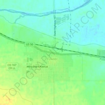
Name: Fowler topographic map, elevation, terrain.
Location: Fowler, Otero County, Colorado, United States (38.12358 -104.03605 38.13805 -104.01654)
Average elevation: 4,334 ft
Minimum elevation: 4,301 ft
Maximum elevation: 4,380 ft
Otero County trails, hiking, mountain biking, running and outdoor activities
Other topographic maps
Click on a map to view its topography, its elevation and its terrain.