Geolocate

Haralson topographic map

Click on the map to display elevation.

About this map

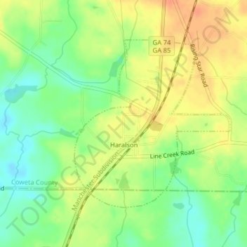
Name: Haralson topographic map, elevation, terrain.

Location: Haralson, Coweta County, Georgia, 30229, United States (33.21967 -84.57780 33.23799 -84.55744)

Average elevation: 820 ft

Minimum elevation: 751 ft

Maximum elevation: 879 ft

Coweta County trails, hiking, mountain biking, running and outdoor activities

Other topographic maps

Click on a map to view its topography, its elevation and its terrain.

East Newnan

United States > Georgia > Coweta County

Average elevation: 951 ft

Arnco Mills

United States > Georgia > Coweta County

Average elevation: 840 ft

Thomas Crossroads

United States > Georgia > Coweta County

Average elevation: 928 ft

McBride

United States > Georgia > Coweta County > Newnan

Average elevation: 919 ft

McCollum

United States > Georgia > Coweta County

Average elevation: 932 ft

Gear up for your next adventure:

🥄Camping Utensil Set - Lightweight utensils for outdoor meals
🪶Wildlife Field Guides - Learn animal tracking and species ID
🧴Hand Sanitizer - Keep hands clean while hiking
Camping Coffee Makers - Enjoy premium coffee at the summit or campsite
🌧️Backpack Rain Cover - Keep gear dry in wet weather

As an Amazon Associate, this site earns from qualifying purchases at no extra cost to you.