Geolocate

Solgohachia topographic map

Click on the map to display elevation.

About this map

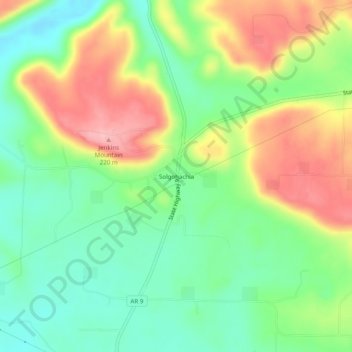
Name: Solgohachia topographic map, elevation, terrain.

Location: Solgohachia, Conway County, Arkansas, 72156, United States (35.23619 -92.69627 35.27619 -92.65627)

Average elevation: 486 ft

Minimum elevation: 305 ft

Maximum elevation: 738 ft

Conway County trails, hiking, mountain biking, running and outdoor activities

Other topographic maps

Click on a map to view its topography, its elevation and its terrain.

Menifee

United States > Arkansas > Conway County

Average elevation: 318 ft

Oppelo

United States > Arkansas > Conway County

Average elevation: 318 ft

Plumerville

United States > Arkansas > Conway County

Average elevation: 348 ft

Morrilton

United States > Arkansas > Conway County

Average elevation: 338 ft

Gear up for your next adventure:

🎒Trekking Poles - Sturdy poles for balance and stability on rough terrain
Solar GPS Watches - Advanced multisport watches with built-in topographic maps
🔦Compact Flashlight - Reliable flashlight for emergencies
🎒Outdoor Daypacks - Lightweight backpacks designed for carrying maps and essential gear
🪶Compact Camp Shovel - Folding shovel for campsite tasks

As an Amazon Associate, this site earns from qualifying purchases at no extra cost to you.