
Pinneberg topographic map
Click on the map to display elevation.
About this map
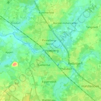
Name: Pinneberg topographic map, elevation, terrain.
Location: Pinneberg, Kreis Pinneberg, Schleswig-Holstein, 25421, Germany (53.62152 9.75679 53.70152 9.83679)
Average elevation: 36 ft
Minimum elevation: 0 ft
Maximum elevation: 112 ft
Other topographic maps
Click on a map to view its topography, its elevation and its terrain.
Heligoland
Germany > Schleswig-Holstein > Kreis Pinneberg > Helgoland > Helgoland
Average elevation: 7 ft
Borstel-Hohenraden
Germany > Schleswig-Holstein > Kreis Pinneberg
On the origin and meaning of the name: "Tho the Borstelde" in "Kerspell Rellinghen" clearly indicate our Borstel. Over the centuries, the name of Borstelde over Borstele, Borstell, Borsteler altered, Barstell to Borstel (the Urdorf). Originally, the name comes from the Old Saxon "bur" = home and "Stal" =…
Average elevation: 39 ft