Geolocate

Wykoff topographic map

Click on the map to display elevation.

About this map

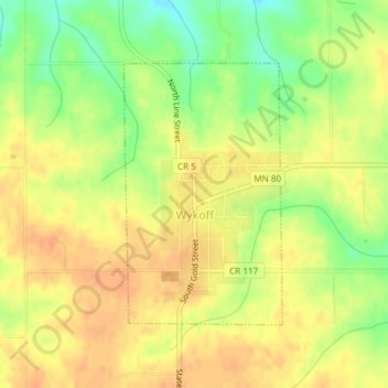
Name: Wykoff topographic map, elevation, terrain.

Location: Wykoff, Fillmore County, Minnesota, 55990, United States (43.69951 -92.27506 43.71772 -92.25978)

Average elevation: 1,306 ft

Minimum elevation: 1,227 ft

Maximum elevation: 1,352 ft

Fillmore County trails, hiking, mountain biking, running and outdoor activities

Other topographic maps

Click on a map to view its topography, its elevation and its terrain.

Chatfield

United States > Minnesota > Fillmore County

Average elevation: 1,073 ft

Highland

United States > Minnesota > Fillmore County

Average elevation: 1,152 ft

Gear up for your next adventure:

👓Polarized Sunglasses - Outdoor sunglasses for glare reduction
🔭Compact Binoculars - HD vision for scouting terrain and identifying distant landmarks
📷Action Camera - Capture your outdoor adventures in HD
🪶Wildlife Field Guides - Learn animal tracking and species ID
🌐World Map Poster - Decorative world maps with topographic info

As an Amazon Associate, this site earns from qualifying purchases at no extra cost to you.