Geolocate

Limestone topographic map

Click on the map to display elevation.

About this map

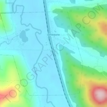
Name: Limestone topographic map, elevation, terrain.

Location: Limestone, Town of Carrollton, Cattaraugus County, New York, 14753, United States (42.01194 -78.65160 42.03305 -78.61952)

Average elevation: 1,572 ft

Minimum elevation: 1,381 ft

Maximum elevation: 2,293 ft

Cattaraugus County trails, hiking, mountain biking, running and outdoor activities

Other topographic maps

Click on a map to view its topography, its elevation and its terrain.

Versailles

United States > New York > Cattaraugus County

Average elevation: 771 ft

Kill Buck

United States > New York > Cattaraugus County

Average elevation: 1,624 ft

Carroll

United States > New York > Cattaraugus County

Average elevation: 1,555 ft

Olean

United States > New York > Cattaraugus County

As a result of its higher elevation, Olean has a cooler humid continental climate (Köppen Dfb) than the larger western New York cities with hot-summer humid continental climates (Dfa).

Average elevation: 1,808 ft

Hinsdale

United States > New York > Cattaraugus County

Average elevation: 1,673 ft

Randolph

United States > New York > Cattaraugus County > Randolph

Average elevation: 1,355 ft

Limestone

United States > New York > Cattaraugus County > Limestone

Average elevation: 1,644 ft

Humphrey

United States > New York > Cattaraugus County

Average elevation: 1,860 ft

Gear up for your next adventure:

🛡️Insect Repellent - Protection against bugs during outdoor activities
🥩Freeze-Dried Meals - Nutritious and lightweight food for remote expeditions
🏫Relief Map Kits - Hands-on tools for teaching landforms and elevation
👖Convertible Hiking Pants - Versatile zip-off pants for changing altitudes and temperatures
Solar GPS Watches - Advanced multisport watches with built-in topographic maps

As an Amazon Associate, this site earns from qualifying purchases at no extra cost to you.