Geolocate

Picton topographic map

Click on the map to display elevation.

About this map

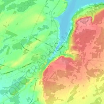
Name: Picton topographic map, elevation, terrain.

Location: Picton, Prince Edward County, Central Ontario, Ontario, M4N 1A5, Canada (43.96771 -77.18117 44.04771 -77.10117)

Average elevation: 367 ft

Minimum elevation: 240 ft

Maximum elevation: 515 ft

Other topographic maps

Click on a map to view its topography, its elevation and its terrain.

Bay of Quinte

Canada > Ontario > Prince Edward County

Average elevation: 325 ft

Gear up for your next adventure:

🛏️Cold Weather Sleeping Bag - Warm sleeping bag for cold conditions
🧤Tactile Hiking Gloves - Keep hands warm while operating GPS and smartphone screens
🦺Reflective Outdoor Gear - Safety gear for low‑light conditions
🪶Camp Gear Gift Set - Perfect gift bundle for outdoor fans
👟Men's Trail Runners - Lightweight footwear for fast-paced exploration and light hiking

As an Amazon Associate, this site earns from qualifying purchases at no extra cost to you.