
Make a donation
Gear up for your next adventure:
As an Amazon Associate, this site earns from qualifying purchases at no extra cost to you.
Chaparral topographic map
Click on the map to display elevation.
Make a donation
Gear up for your next adventure:
As an Amazon Associate, this site earns from qualifying purchases at no extra cost to you.
About this map
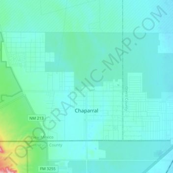
Name: Chaparral topographic map, elevation, terrain.
Location: Chaparral, Doña Ana County, New Mexico, United States (32.00095 -106.52877 32.08247 -106.37697)
Average elevation: 4,085 ft
Minimum elevation: 3,990 ft
Maximum elevation: 4,875 ft
Doña Ana County trails, hiking, mountain biking, running and outdoor activities
Make a donation
Gear up for your next adventure:
As an Amazon Associate, this site earns from qualifying purchases at no extra cost to you.
Other topographic maps
Click on a map to view its topography, its elevation and its terrain.
Las Cruces
United States > New Mexico > Doña Ana County > Las Cruces
The approximate elevation of Las Cruces is 3,908 feet (1,191 m) above sea level.
Average elevation: 4,314 ft
Make a donation
Gear up for your next adventure:
As an Amazon Associate, this site earns from qualifying purchases at no extra cost to you.
Organ Mountains Historical Marker
United States > New Mexico > Doña Ana County
Average elevation: 7,526 ft