Geolocate

Sanco topographic map

Click on the map to display elevation.

About this map

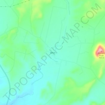
Name: Sanco topographic map, elevation, terrain.

Location: Sanco, Coke County, Texas, United States (31.98847 -100.54399 32.02847 -100.50399)

Average elevation: 2,113 ft

Minimum elevation: 1,985 ft

Maximum elevation: 2,497 ft

Coke County trails, hiking, mountain biking, running and outdoor activities

Other topographic maps

Click on a map to view its topography, its elevation and its terrain.

Robert Lee

United States > Texas > Coke County

Average elevation: 1,831 ft

Gear up for your next adventure:

🧭Orienteering Set - Complete compass and map reading kit
🌎3D Topographic Globes - Raised relief globes for a tactile understanding of geography
🕶️GPS Smartphone Mount - Secure mount for phone navigation
🪄Magnetic Compass - Accurate compass for navigation
❄️Traction Cleats - Prevent slips on icy trails during winter hikes

As an Amazon Associate, this site earns from qualifying purchases at no extra cost to you.