
Okay topographic map
Click on the map to display elevation.
About this map
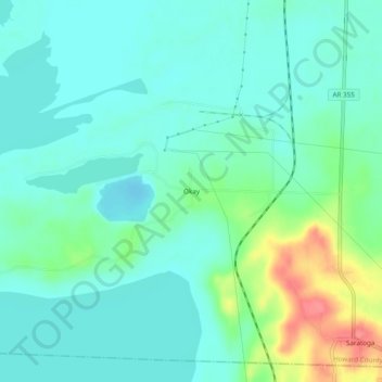
Name: Okay topographic map, elevation, terrain.
Location: Okay, Howard County, Arkansas, 71859, United States (33.74762 -93.94408 33.78762 -93.90408)
Average elevation: 295 ft
Minimum elevation: 236 ft
Maximum elevation: 479 ft
Howard County trails, hiking, mountain biking, running and outdoor activities
Other topographic maps
Click on a map to view its topography, its elevation and its terrain.